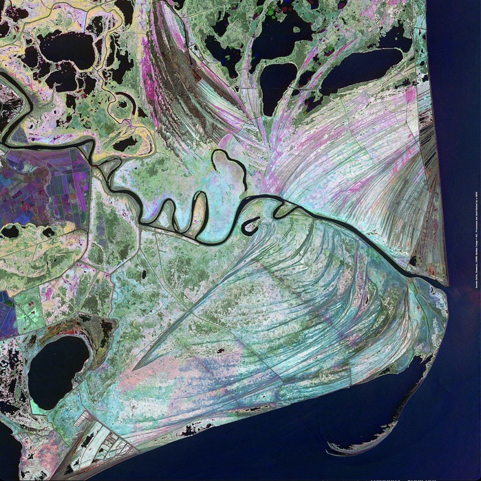
Protagonist of the most famous of all waltzes, On the Beautiful Blue Danube by Johann Strauss Jr, the Danube has its source in the Black Forest, at the foot of the Alps, and then follows a very special course as it veers towards the interior of Europe and covers 2,858 kilometres before flowing into the Black Sea. Its mouth, a delta covering more than 4,000 square kilometres, is Europe's largest wetland, home to millions of migratory birds, including the pygmy cormorant, every year, and among the many canals and ponds there are at least 45 species of freshwater fish, which is why it has been declared a UNESCO World Heritage Site.
To celebrate World Rivers Day, e-Geos - a company made up of Telespazio (80%) and the Italian Space Agency (20%) - has selected a detail of the delta created using data from COSMO-SkyMed, the satellite constellation built by the Italian Space Agency with the Ministry of Defence.The area is constantly changing and the colours of the image – generated using three amplitude radar images, collected in different time periods (the red, green and blue colours relate to three different dates) – visually demonstrate the constant changes caused by the annual floods, when the river brings huge quantities of sediment that shape the thousands of canals and islets. However, combined with the shrinkage of the Alpine glaciers, the increasing number of dams that have been built along this almost 3,000-kilometre stretch has decreased the flow of water and sediment, so much so that the delta has started to shrink in recent years.
Leggi l'articolo completo su ANSA.it